


Christchurch Visitor & Tourist Metromap 263
- ISBN #9415871001116
- METROMAP
- In Store Only
- In Store Only
Christchurch Visitor & Tourist Metromap 263
- ISBN #9415871001116
- METROMAP
- In Store Only
- In Store Only
$10.43 ex GST
- Product Details
- Delivery & Returns
-
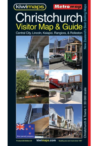
Christchurch Visitors' Street Plan at 1:30,000 with a detailed enlargement for the town centre and a plan of the city's international airport. The main plan covers the city with its outer suburbs and is extended by separate panels to include Lincoln, Templeton, Belfast, Rolleston, Kaiapoi, Rangiora and Ashley, all with street indexes. The plans show one way streets, railway lines with stations, ferry terminals, public buildings, etc. Also shown are boundaries of postal districts and postcodes. An unusual feature of the map is an unobtrusive circular radius grid showing distance from the Central Post Office building in Christchurch.
- Publication Date: 01/04/1996
- 880 x 615mm
- Sheet Map, folded
-
There is no Handling & Delivery cost for orders over $50 ex GST unless there are large items in your order.
Orders under $50 (ex GST) & excluding Gift Card only orders :
$6.00 ex GST ($6.90 incl GST)
Surcharge for Rural Delivery addresses $3.13 ex GST ($3.60 incl GST) for orders under $50 ex GST
Orders with only Gift cards under $50 are charged $2.52 ex GST ($2.90 incl GST)There is no Handling & Delivery cost for eGift card orders.
Charges for Large or Bulky items . These are indicated by the Large item icon.
Regardless of total order value: first unit $8.70 ex GST ( $10 incl GST), then every subsequent unit $4.35 ex GST ($5 incl GST)Read more about Delivery Information
Read our Returns and Exchanges Policy
-
Product Details
Christchurch Visitors' Street Plan at 1:30,000 with a detailed enlargement for the town centre and a plan of the city's international airport. The main plan covers the city with its outer suburbs and is extended by separate panels to include Lincoln, Templeton, Belfast, Rolleston, Kaiapoi, Rangiora and Ashley, all with street indexes. The plans show one way streets, railway lines with stations, ferry terminals, public buildings, etc. Also shown are boundaries of postal districts and postcodes. An unusual feature of the map is an unobtrusive circular radius grid showing distance from the Central Post Office building in Christchurch.
- Publication Date: 01/04/1996
- 880 x 615mm
- Sheet Map, folded
- Delivery & Returns