


Maps, Annotated
- ISBN #9780241682845
- DK
- Hardback
- In Store Only
- In Store Only
Maps, Annotated
- ISBN #9780241682845
- DK
- Hardback
- In Store Only
- In Store Only
$65.21 ex GST
- Product Details
- Delivery & Returns
-
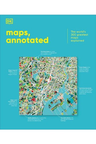
This glorious guided tour of cartographic history features more than 300 of the most famous and important maps of all time. Immerse yourself in ancient Chinese star charts, decipher medieval Mappae Mundi, and marvel at intricate surveys of the ocean floor and the lunar surface. Discover how Polynesian navigators used sticks to chart their way across the Pacific, what a rhumb line is, and where dragons were once said to lurk. Organized chronologically, the book includes the most celebrated examples of maps spanning more than 5,000 years, explaining everything from scales and compasses to meteorological symbols, and exploring techniques from engraving and printing to cartographic projection. Entries also place the maps in their wider cultural and historical context, providing a complete overview of the subject. Combining stunning reproductions with precise annotation, visual analysis, and pull-out details, Maps, Annotated brings an expertly curated selection of the world's most celebrated maps right into your home, telling the fascinating stories behind each one.
- Format: Hardback
- Publication Date: 30/09/2025
- Publisher: Dorling Kindersley Ltd
- Country of Origin: United Kingdom
- Pages: 480
- Dimensions (mm): 286x242x36mm
- Weight: 2408g
-
There is no Handling & Delivery cost for orders over $50 ex GST unless there are large items in your order.
Orders under $50 (ex GST) & excluding Gift Card only orders :
$6.00 ex GST ($6.90 incl GST)
Surcharge for Rural Delivery addresses $3.13 ex GST ($3.60 incl GST) for orders under $50 ex GST
Orders with only Gift cards under $50 are charged $2.52 ex GST ($2.90 incl GST)There is no Handling & Delivery cost for eGift card orders.
Charges for Large or Bulky items . These are indicated by the Large item icon.
Regardless of total order value: first unit $8.70 ex GST ( $10 incl GST), then every subsequent unit $4.35 ex GST ($5 incl GST)Read more about Delivery Information
Read our Returns and Exchanges Policy
-
Product Details
This glorious guided tour of cartographic history features more than 300 of the most famous and important maps of all time. Immerse yourself in ancient Chinese star charts, decipher medieval Mappae Mundi, and marvel at intricate surveys of the ocean floor and the lunar surface. Discover how Polynesian navigators used sticks to chart their way across the Pacific, what a rhumb line is, and where dragons were once said to lurk. Organized chronologically, the book includes the most celebrated examples of maps spanning more than 5,000 years, explaining everything from scales and compasses to meteorological symbols, and exploring techniques from engraving and printing to cartographic projection. Entries also place the maps in their wider cultural and historical context, providing a complete overview of the subject. Combining stunning reproductions with precise annotation, visual analysis, and pull-out details, Maps, Annotated brings an expertly curated selection of the world's most celebrated maps right into your home, telling the fascinating stories behind each one.
- Format: Hardback
- Publication Date: 30/09/2025
- Publisher: Dorling Kindersley Ltd
- Country of Origin: United Kingdom
- Pages: 480
- Dimensions (mm): 286x242x36mm
- Weight: 2408g
- Delivery & Returns
You might also like...
20% OFF BOOKS
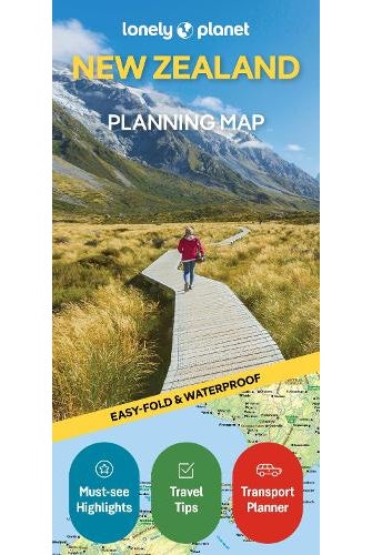
Lonely Planet New Zealand Plan...
now $13.90 ex GST was $17.38

20% OFF BOOKS
Lonely Planet Southeast Asia P...
now $10.43 ex GST was $13.03


Recently Viewed


You might also like...
20% OFF BOOKS
Lonely Planet New Zealand Plan...
now $13.90 ex GST was $17.38
20% OFF BOOKS
Lonely Planet Southeast Asia P...
now $10.43 ex GST was $13.03